The Habitat Cartography Program aims to centralize geospatial data essential for the functioning of our conservation programs. Its goal is to create tools for the study and integrated management of the coastal ecosystems of Mahahual, including reefs, coastal dunes, seagrass beds, and mangrove forests.
This program adopts a multidisciplinary approach, utilizing data collection methods from both natural and social sciences. These methods include satellite imagery remote sensing, drone aerial orthophotography and photogrammetry, sonar bathymetry, piezometry, terrestrial and underwater characterization expeditions, and participatory mapping workshops with the community. The data is processed and analyzed using digital Geographic Information Systems (GIS), allowing us to overlay and triangulate a wide variety of information sources.
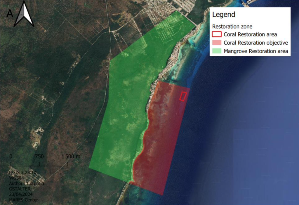
The resulting maps are used by our monitoring and restoration projects and are freely available to support local conservation initiatives. These maps subdivide the territory of Mahahual into habitats and study sites, simplifying the analysis of the state and dynamics of ecosystems as well as anthropogenic pressures. To date, the project has developed a cartographic database of Mahahual’s underwater and terrestrial habitats, covering 12 km of coastline. This includes mapping the reef and restoration area, mangrove forest mapping, hydrology mapping, and elevation modeling, among others. Additionally, we have an interactive web map to share information with the Mahahual community, students, and scientists interested in our research topics.